
- Back in the day, on occasion, a hop skip and a jump could get you across the Mississippi here and about.
- Who to blame for low water?
- Droughts back then caused by intense wigwam and teepee fires, oh, and buffalo flatulence as plains Indians gave them protected status
- Coincidence, we think not, it all proves climate change caused by man.
- Deplorable to alter “nature” to benefit mankind and his evil commerce.
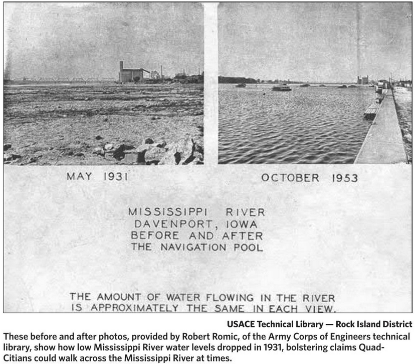
This interesting article by Marlene Gantt appears in today’s Dispatch- Argus. The DA is largely DOA to us now that it is little sister to the QC Times as part of the Lee Enterprises group. But as some holdover columnists remain we occasionally open it if only to find what to poke at. Occasionally we find something to point to. This is one. We show the photo for you below as it was not available in the online version even thought the title refers to “photos.” Excerpts here but the entire article is worthy to contemplate.
Photos, research bolster river-waders claims
In July 1910, wading across the Mississippi River was said to be commonplace because of the low water level. All river traffic was suspended. More than river commerce suffered. Fish died in brackish, stagnant water. Dead vegetation drying in the sun often caught on fire and burned, causing a smoke pall.
In May 1931, Quad-Cities river commerce fell to zero. The bedrock that caused the Rock River Rapids was visible for miles, and the river was reduced to a mere trickle and was only .89 inches above the zero mark on the Rock Island-Davenport Bridge Gauge, which was set on the low water mark of 1864, according to Ron Deiss, of the U.S. Army Corps of Engineers Mississippi Valley Division, in the article, “Fluctuations of the Upper Mississippi River With Special Attention to the Quad-Cities” for “The Egregious Steamboat Journal.”
Mr. Deiss sent us several sets of photos of low water or no water in the river taken before the lock-and-dam system was built.
“The photos are from Robert Romic in our library,” Deiss wrote in an email. “They seem to date from 1880 to 1930. The 1864 low water was the extreme low water mark. Bedrock and the river bed were exposed along the near length of the river. There was no doubt there were areas that held water especially in the natural thalwegs and outside of the river bends. But that water evaporated and got stagnant.” (Thalweg is a line connecting the lowest points of successive cross-sections along the course of a valley or river defining its deepest channel.)
You could say that before the lock-and-dam system on the Mississippi and the 9-foot channel, “seldom were any of the rivers of convenient stage, their habitude was for either floods or shoals,” said Charles Russell in his book “A-Raftin on the Mississipi,” published in 1928.
In 1864, for some unexplained reason, the upper Mississippi nearly went out of business, recording the lowest water ever known. Passengers bound for St. Paul had an interesting time at Dubuque. They had to transfer to a light-draft steamer (if any) that took them as far as LaCrosse. Thereafter, they fared as chance offered, land or water.
A Dubuque newspaper said above LaCrosse, the river was not navigable except shingles and light skiffs and suggested wading. The St. Paul Pioneer responded with fiery indignation.
“Most persons believed that the end had come to river navigation. Two years later the whole region was flooded.” . . .
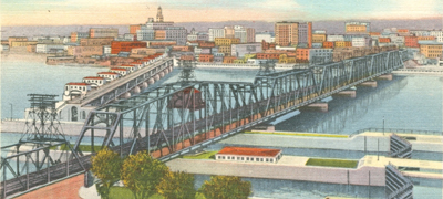
The Davenport / Rock Island roller dam is the largest in the world. Construction began in 1931 as part of a series of 26 extending from the Twin Cities to near St Louis. More reading about roller dams on the Mississippi, here and here. R Mall